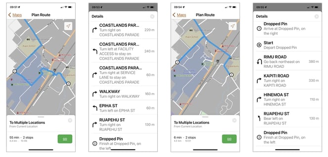
The Network enables accurate estimation of journey times, with optimal routing for delivery efficiency and fleet management so that organisations can streamline their logistics operations. Used in conjunction with Routing/Drive-time software, the module allows for turn-by-turn directions to be provided to field staff or customers, as well as driving/walking distances and travel times to reach services/customers. The routing data contained within the Network provides information on road types, surface, average speeds, direction, turn restrictions, as well as one-way streets and roundabout coding.
Walking and driving travel modes in ArcGIS Navigator
Road attributes included as standard
Also available as custom supply

The Network provides a fully navigable road network of comprehensive layers and datasets. Standardised road names and abbreviations minimise the risk of confusion or mislabelling and the richness of the road attributes supports very accurate, and realistic, road travel modelling.
The Network is updated monthly following an extensive QA process, with a roadmap for 2024 that includes the addition of a cycle routing mode, as well as GTFS data to create a public transport travel mode.