Many New Zealand Local and Central Government agencies are doing a great job of providing free public access to the data they collect and create. For example, The Land Information New Zealand (LINZ) Data Service (LDS) has over 2,100 datasets available for free download in various geospatial formats.
However, private sector geodata companies are still producing datasets and selling them for money. So, are these private companies just duplicating the efforts of these agencies or, worse, are they just freeloading and re-packaging freely available government data for profit without adding any value?
What value can private sector data companies add to public data? In this post, I aim to answer the question: “Why would I want to pay for road centrelines when I can download them for free?” by exploring road centrelines data.
Fit for Purpose
Currently LINZ have two types of road centreline data available on their data portal: cadastral (legal) and topographic (real world).
Cadastral centrelines are from the Landonline (LOL) database. They were originally digitised in LOL’s predecessor, the Digital Cadastral Database (DCDB), in order to position a road name on a cadastral record map. The topographic centrelines have been created to display roads on the LINZ 1:50000 topographic maps. It is important to understand the origin of these datasets before we try use them for something that they were never intended to be used for.
The first question that needs to be asked when evaluating a dataset for use is: “What will the data be used for?” Once we have clarified that, we can then consider what datasets are available and how suitable they will be for our purpose. For example, if I simply want a background map for a small-scale mapping project and I’m not too worried about currency and positional accuracy, then the freely available topographic centrelines will suit my purpose. However, if I want to do network analysis like routing or resource allocation, then I will need topological qualities such as reliable road connectivity, turn restrictions, and over/underpasses, as well as speed limits, road surface type, and road hierarchy. It is these additional refinements that are not available from datasets currently on the LINZ data portal.
When it comes to spatial data and, specifically, road data, ensuring fitness-for-purpose can be the difference between a successful project and accurate results, or project delays and unhappy customers.
When evaluating 'fitness for purpose' of road data, you need to look at the following three components: positional accuracy (alignment), attribution and currency.
Positional Accuracy
GIS data, just like a paper map, is an abstraction of reality and, as such, it suffers from positional inaccuracy and imprecision. The level of positional accuracy required varies on the use of the data. For example road data, engineering, asset management and routing projects all require very precise information, whereas a map of an area for marketing purposes is less precise.

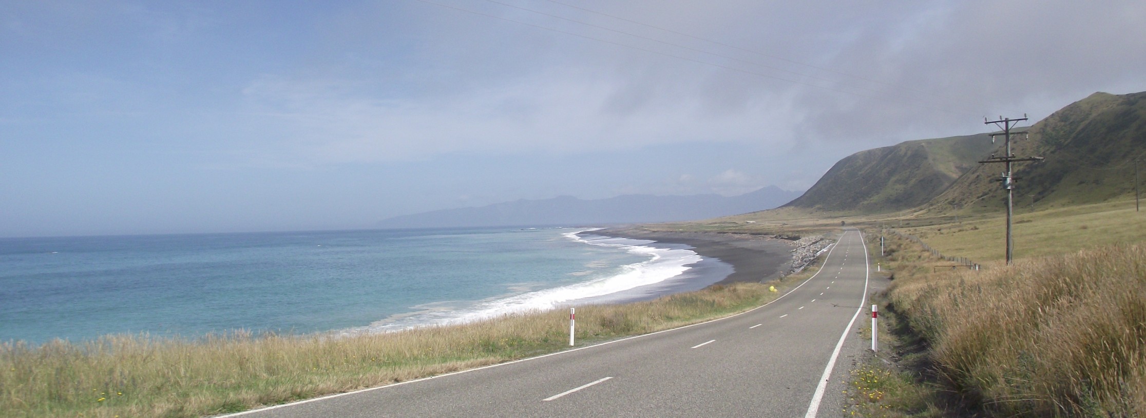
Accurate representation of real-world road alignment, including dual carriageways and complex intersection geometry is very important for routing applications.
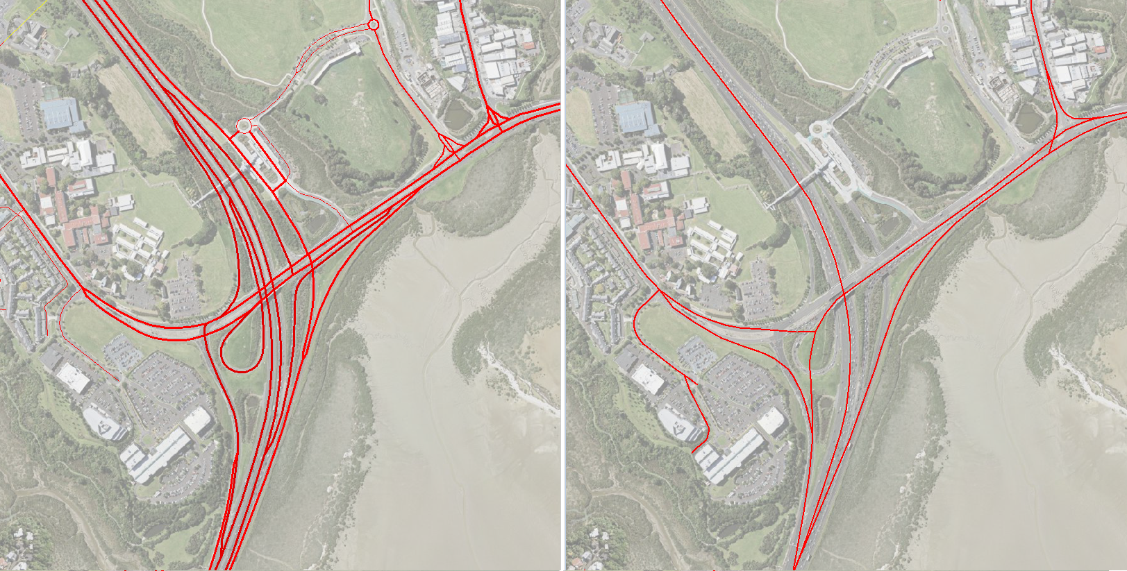
Currently, the two sets of road data on the LDS tend to follow either the legal (or cadastral) alignment, or the topographic alignment that provides sufficient positional accuracy for high level regional and national, visually appealing, mapping and analysis needs. However, the alignment does not represent the real-world accurately enough for most engineering, roading or routing projects, where the positional accuracy in certain areas is needed in fine detail,
Attribution
The geometry and positional accuracy of a road only tells half the story. A full set of attributes adds immense value to the data by identifying such things as signposted and alternative naming, the legal speed limit and average speed of travel, road hierarchy, and legal information.
Naming variations
The signposted name is most important, as it is what identifies the road to people who live on or and travel along it. The signposted name may well differ from the legal name, which is what government and LINZ data show. When the legal name differs from the signposted name, it is desirable to record this in a separate field.
There are situations where a local name used for a road differs from both the signposted and legal names. Again where this occurs, it is desirable to record this local name in an alternative name field.
Speed attributes
While it is useful to know the legal speed limit, in some use cases, it is often more important to know the average speed that a vehicle, cyclist or pedestrian could be expected to travel on a particular section of road. This average speed needs to take into account factors such as road surface and the number of corners and bends, as well as any high scenic value that may cause tourists to experience longer travel times than they would expect.
Currently, neither of the publicly available datasets mentioned above contain speed information, so finding, assembling and maintaining this information necessitates a significant investment. New Zealand speed limits are set by the 66 Road Controlling Authorities (RCAs) and, as speeds can vary greatly along the length of a road and are subject to regular change, it is necessary to have processes in place to continuously review any speed limit changes.
Other attributes
Other attributes not currently in the publicly available data sets, but that are vitally important to routing and mapping applications, are:
- Direction of travel along one-way roads and dual carriageway roads.
- The concept of a road hierarchy – this is particularly important when routing vehicles.
- The ability to be able to differentiate between Legal, Private, Non-Legal Roads, Military Roads and Roads within Gated Communities.
- Travel restrictions like height and weight limits, as well as no right/left turn information
Currency of data
Developers, infrastructure planners and engineers all need to be aware of plans for future roading developments. However, it is important to flag these roads as proposed only, as often the alignment of these roads will change by the time the road is built.
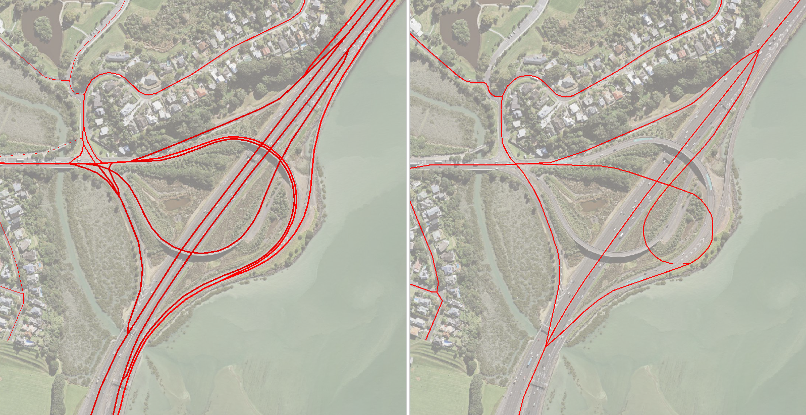
NationalMap (left map above) is constantly updated with the very latest changes to roading infrastructure.
To stay ahead of roading changes requires constant maintenance and being proactive across a number of sources of change intelligence, including:
- Road Controlling Authorities (RCAs)
- The national RAMM databases (Road Assessment and Maintenance Management)
- Changes in the LINZ topographic and cadastral roads patterns
- Local news feeds, for information on when new roading developments become live.
Conclusion
While it is a great luxury to operate in a country where local and central government makes so much of its data freely available, there are limits to how useful these data can be for many commercial purposes, and there are a number of traps for unwary players. Only by properly assessing the “fitness for purpose” of a particular dataset can you determine how well it will support your requirements. While the saying, "you pay for what you get" is often used, when it comes to open data and the road datasets available for New Zealand at the present time, it’s more of a case of, "you don’t get what you don’t pay for".