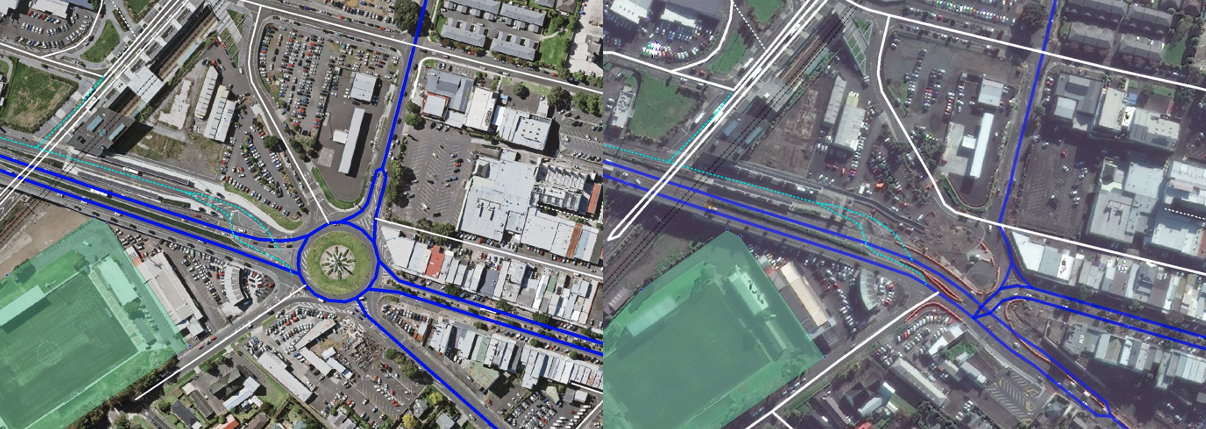
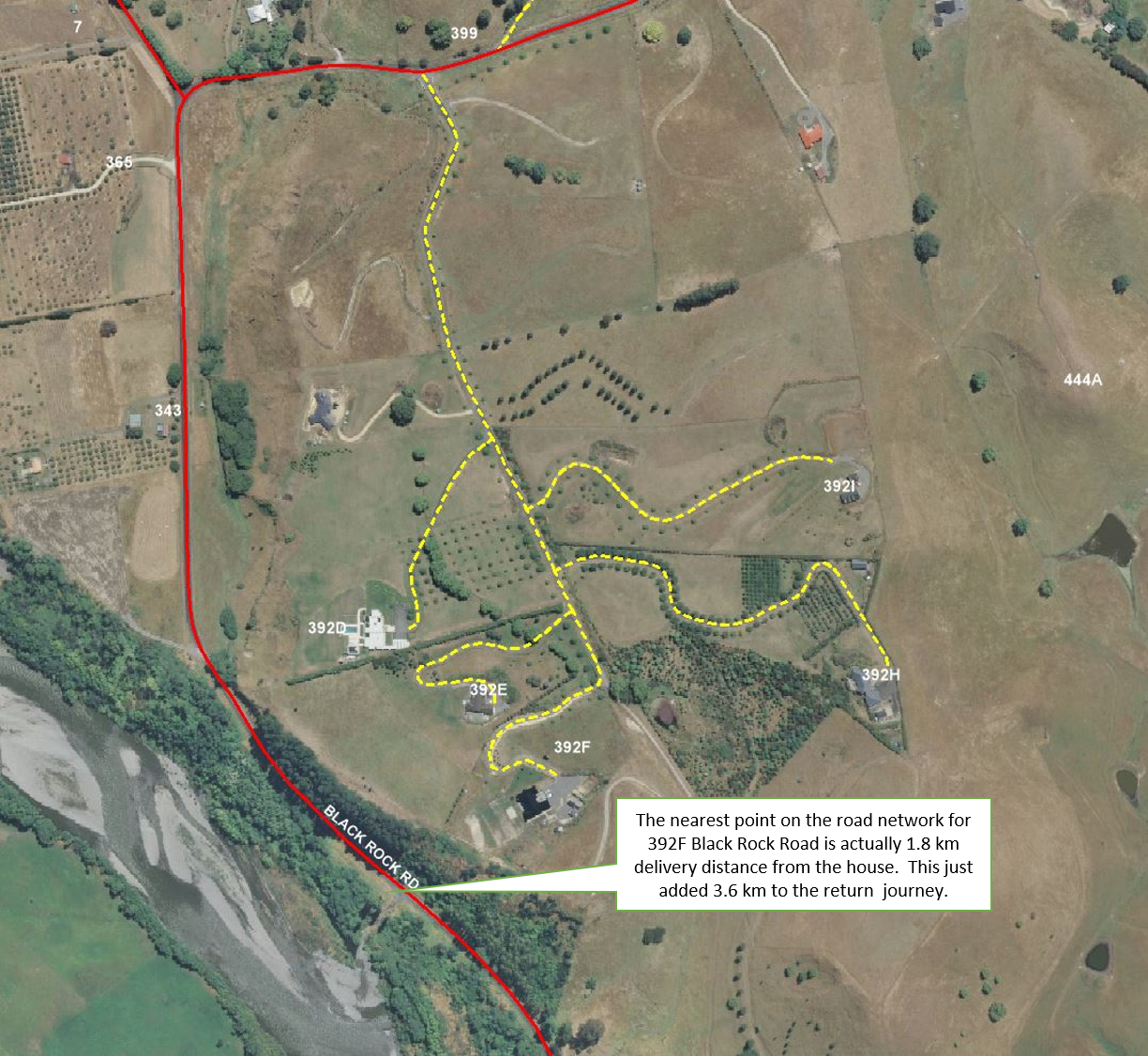
I absolutely love imagery. It is a source of truth in an ever-changing world and one of the most useful tools for creating and maintaining the accurate, reliable, and current road network we provide in NationalMap.
Derek Love, Data Lead
Recent Posts
It’s always made sense to “buy local” when it comes to procuring accurate GIS data
Jul 3, 2020 10:17:06 AM / by Derek Love, Data Lead
The ongoing development at Auckland's Panmure bus interchange – left showing previous layout, on previously available aerial photos and right the new layout on the latest satellite imagery
Here at NationalMap, we pride ourselves on getting things right and we’ve been doing this for 30 years.
Quality is our focus; it’s there to provide our customers with confidence and assurance that any analyses or tasks they undertake are underpinned by data they can trust.
Routing can be a complicated beast, but at its simplest level, it comes down to:
- Address point location and proximity to roads; and
- Linking said address point to the most appropriate location or roadlink.