

Major international airports and the cities they serve are often intwined in our collective consciousness (think Heathrow and London, or JFK and New York). However, as anyone who has travelled on budget airlines in Europe can attest to, the distance between airports and the cities they purport to be serving can often be many, MANY miles.

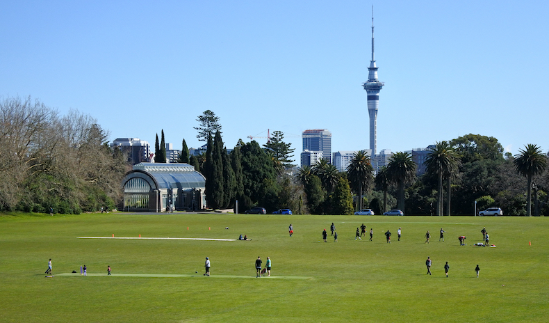
Prior to the advent of the motor car most cities were probably by default organised in a way that allowed residents to meet most of their daily needs within a 15-minute walk from their homes. However, the impact of things like motorways, traffic congestion and urban sprawl have meant that for many cities, the distance to essential amenities for its citizens has gradually increased over the years.
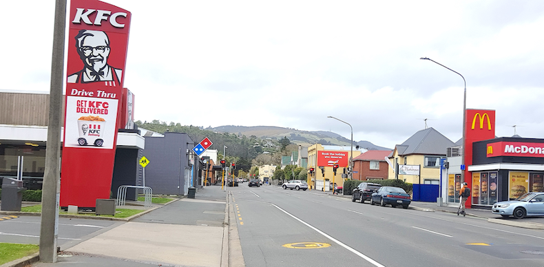
For the third blog in our series on the relationship between people and their proximity to amenities (for which we use one or more of our extensive points of interest POI data sets) we have focused on fast-food or “quick service restaurants”.

For the second blog in our series on the relationship between people and their proximity to amenities (for which we use one or more of our extensive points of interest POI data sets) we have focused on retirement villages and resthomes.
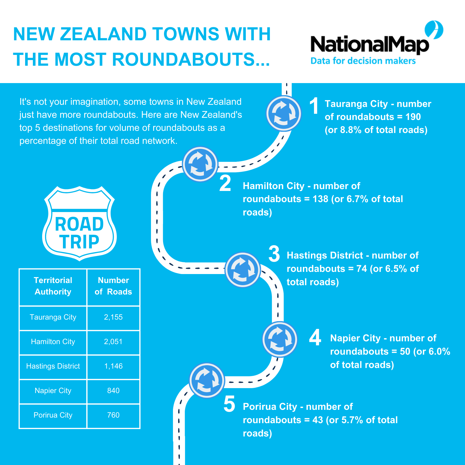
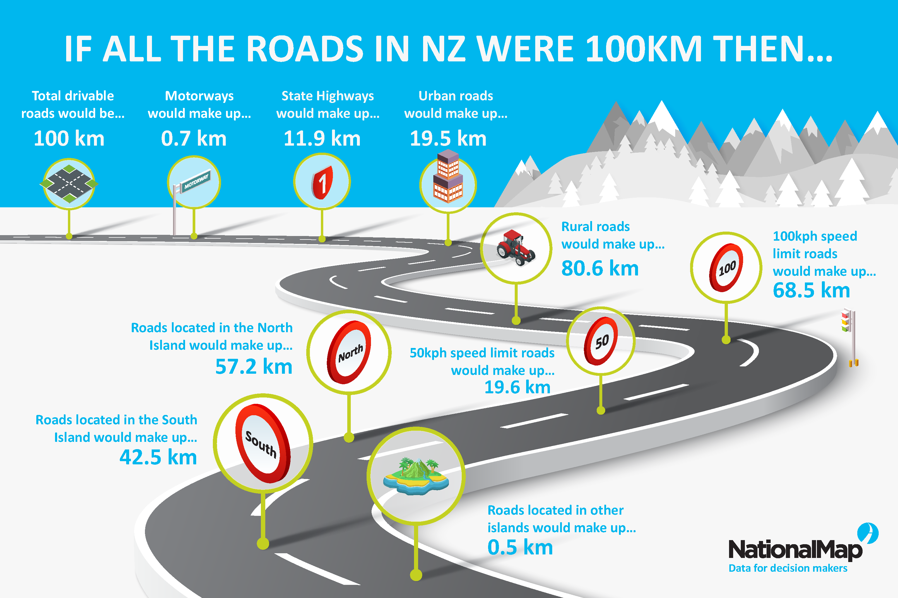
Over the last few weeks, the NationalMap team have been working on a project for a client that is largely based around identifying the physical attributes, infrastructure and amenities of our cities and towns.

Last week the Government released New Zealand’s first Emissions Reduction Plan. There’s a lot to absorb (it’s 350 pages long), but with the biggest section of the plan dedicated to transport, it’s very clear that the transport sector has a huge role to play in getting New Zealand to net-zero emissions by 2050.

With the certainties of yesterday seeming like they belong to a different age, it can feel like businesses are having to adapt to a “new normal” almost every day now.
Are we out of the Covid-19 woods yet? Or does the growing outbreak in China herald not only global supply chain disruption, but a new wave of the virus?
Image credit: LINZ & Kāpiti Coast District Council