

Every little bit helps. It’s a statement that really couldn’t be truer than when it comes to tackling the challenge of climate change and environmental sustainability.

I absolutely love imagery. It is a source of truth in an ever-changing world and one of the most useful tools for creating and maintaining the accurate, reliable, and current road network we provide in NationalMap.
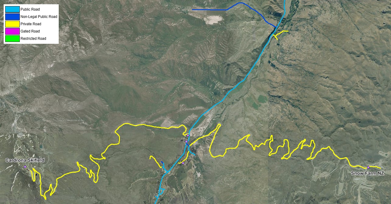
The above image visualises the legal status of the roads around Cardrona ski field - a number of which are not legally defined as "public roads".
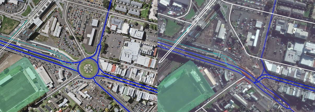
The ongoing development at Auckland's Panmure bus interchange – left showing previous layout, on previously available aerial photos and right the new layout on the latest satellite imagery